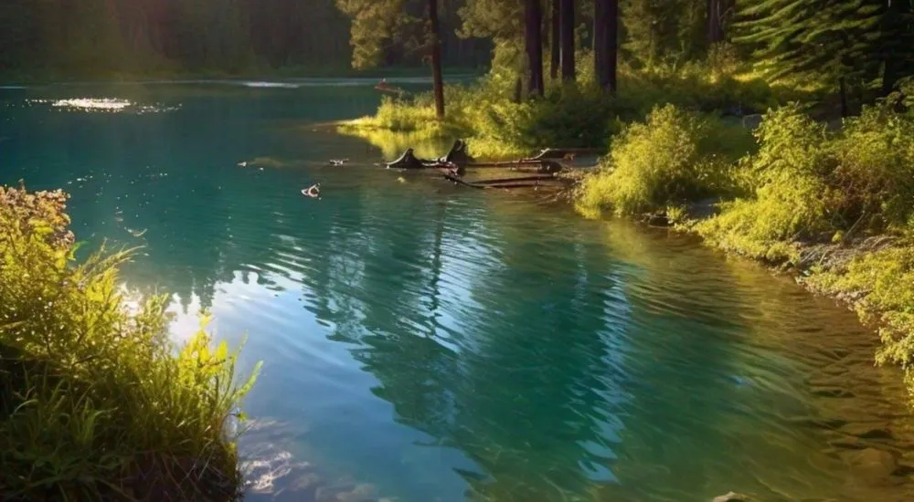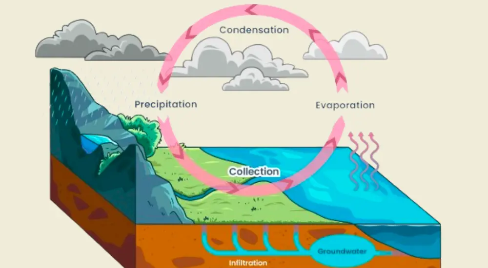
Groundwater hydrology, also known as hydrogeology or geohydrology, is the study of the water that resides beneath the surface of Earth in soil pore spaces and fractures of rock formations. It deals with the occurrence, distribution, and quantification of the groundwater. This underground water source is a crucial part of the water cycle, supplying wells, springs, and aquifers. Hydrologists use techniques like aquifer tests, water sampling, and computer modelling to understand groundwater flow and contamination risks. By restricting overuse and pollution of groundwater, we can protect this vital resource of life, ensuring it remains a reliable source of fresh water for future generations.
1. What is the zone of saturation in groundwater hydrology?
(A) The area where water infiltrates the soil
(B) The area where the pore spaces are completely filled with water
(C) The area where the pore spaces contain both air and water
(D) The area above the water table
(B) The area where the pore spaces are completely filled with water
Explanation: The zone of saturation is the area in the subsurface where all the pore spaces are completely filled with water, as opposed to the zone of aeration above it where pores contain both air and water.
2. What is the water table?
(A) The top of the zone of saturation
(B) The boundary between soil and bedrock
(C) The surface layer of an aquifer
(D) The depth at which groundwater is found
(A) The top of the zone of saturation
Explanation: The water table is the upper surface of the zone of saturation where groundwater pressure is equal to atmospheric pressure.
3. What is an aquifer?
(A) A body of rock that can store and transmit significant amounts of groundwater
(B) A type of spring
(C) A surface water reservoir
(D) A type of well
(A) A body of rock that can store and transmit significant amounts of groundwater
Explanation: An aquifer is a geological formation that can store and transmit significant quantities of groundwater, making it a valuable resource for water supply.
4. What is the process by which groundwater is replenished?
(A) Condensation
(B) Infiltration
(C) Transpiration
(D) Evaporation
(B) Infiltration
Explanation: Infiltration is the process by which surface water permeates the soil and recharges groundwater supplies.
5. What is the term for the movement of groundwater through the subsurface?
(A) Percolation
(B) Sublimation
(C) Diffusion
(D) Advection
(A) Percolation
Explanation: Percolation refers to the movement of water through the soil and porous rock layers in the subsurface, driven by gravity and capillary forces.
6. What type of aquifer is bounded above and below by confining layers?
(A) Unconfined aquifer
(B) Confined aquifer
(C) Perched aquifer
(D) Artesian aquifer
(B) Confined aquifer
Explanation: A confined aquifer is bounded above and below by impermeable or low-permeability layers, which confine the groundwater under pressure.
7. Which type of well taps into a confined aquifer and allows water to rise above the top of the aquifer without pumping?
(A) Dug well
(B) Driven well
(C) Artesian well
(D) Collector well
(C) Artesian well
Explanation: An artesian well taps into a confined aquifer, and due to the pressure within the aquifer, water can rise above the top of the aquifer without the need for pumping.
8. What is the main cause of groundwater contamination?
(A) Natural filtration
(B) Over-pumping of wells
(C) Infiltration of pollutants from the surface
(D) Reduction in recharge areas
(C) Infiltration of pollutants from the surface
Explanation: Groundwater contamination is mainly caused by the infiltration of pollutants such as chemicals, waste, and other contaminants from the surface into the groundwater system.
9. What is the hydraulic gradient?
(A) The slope of the water table
(B) The rate at which groundwater flows
(C) The pressure difference between two points in the groundwater
(D) The total volume of water in an aquifer
(A) The slope of the water table
Explanation: The hydraulic gradient is the slope of the water table or potentiometric surface, indicating the direction and rate of groundwater flow.
10. What is the primary function of a groundwater recharge area?
(A) To store groundwater
(B) To allow water to infiltrate and replenish an aquifer
(C) To provide a natural filtration system
(D) To create a natural barrier to groundwater flow
(B) To allow water to infiltrate and replenish an aquifer
Explanation: A groundwater recharge area is a region where water infiltrates the ground and replenishes an aquifer, maintaining the groundwater supply.
11. What is the primary factor that controls the storage and movement of groundwater in an aquifer?
(A) Soil colour
(B) Rock hardness
(C) Porosity and permeability
(D) Surface vegetation
(C) Porosity and permeability
Explanation: Porosity refers to the percentage of void space in a rock or soil, while permeability is the ability of a material to transmit fluids. Together, they control the storage and movement of groundwater in an aquifer.
12. Which type of rock typically forms the best aquifers due to its high porosity and permeability?
(A) Granite
(B) Shale
(C) Sandstone
(D) Basalt
(C) Sandstone
Explanation: Sandstone typically forms the best aquifers because it usually has high porosity and permeability, allowing it to store and transmit significant amounts of groundwater.
13. What is a perched aquifer?
(A) An aquifer confined by two impermeable layers
(B) An aquifer that lies above the main water table due to an underlying impermeable layer
(C) An aquifer that extends below sea level
(D) An aquifer that is affected by tidal forces
(B) An aquifer that lies above the main water table due to an underlying impermeable layer
Explanation: A perched aquifer is one that sits above the main water table due to the presence of an underlying impermeable layer that prevents water from percolating down to the primary aquifer.
14. Which term describes the area around a well where the water table has been lowered due to pumping?
(A) Cone of depression
(B) Hydraulic head
(C) Drawdown zone
(D) Saturated zone
(A) Cone of depression
Explanation: The cone of depression is the area around a well where the water table has been lowered as a result of groundwater being pumped out faster than it can be recharged.
15. What is the main purpose of groundwater modelling?
(A) To predict weather patterns
(B) To simulate and understand groundwater flow and contaminant transport
(C) To measure soil acidity
(D) To monitor seismic activity
(B) To simulate and understand groundwater flow and contaminant transport
Explanation: Groundwater modelling is used to simulate and understand the behaviour of groundwater flow and the transport of contaminants, helping in resource management and contamination mitigation.